Log in
All resources
Create a design
310 Free Images of 1867 Maps
maps in the library of congress
albert ruger
cc-zero
pages with maps
old maps of wisconsin
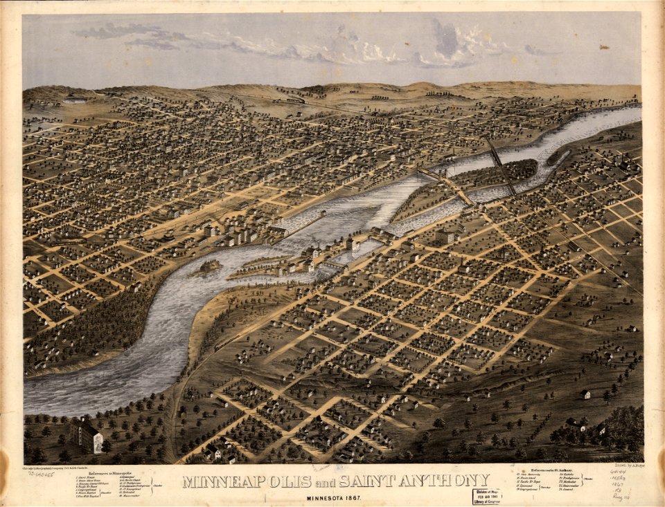
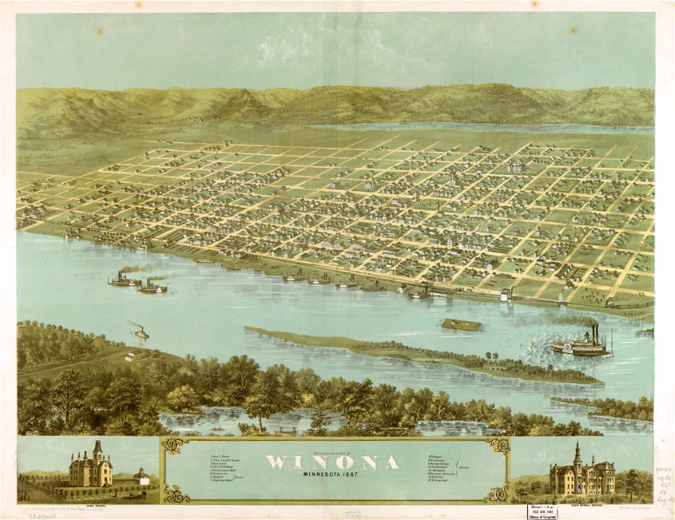
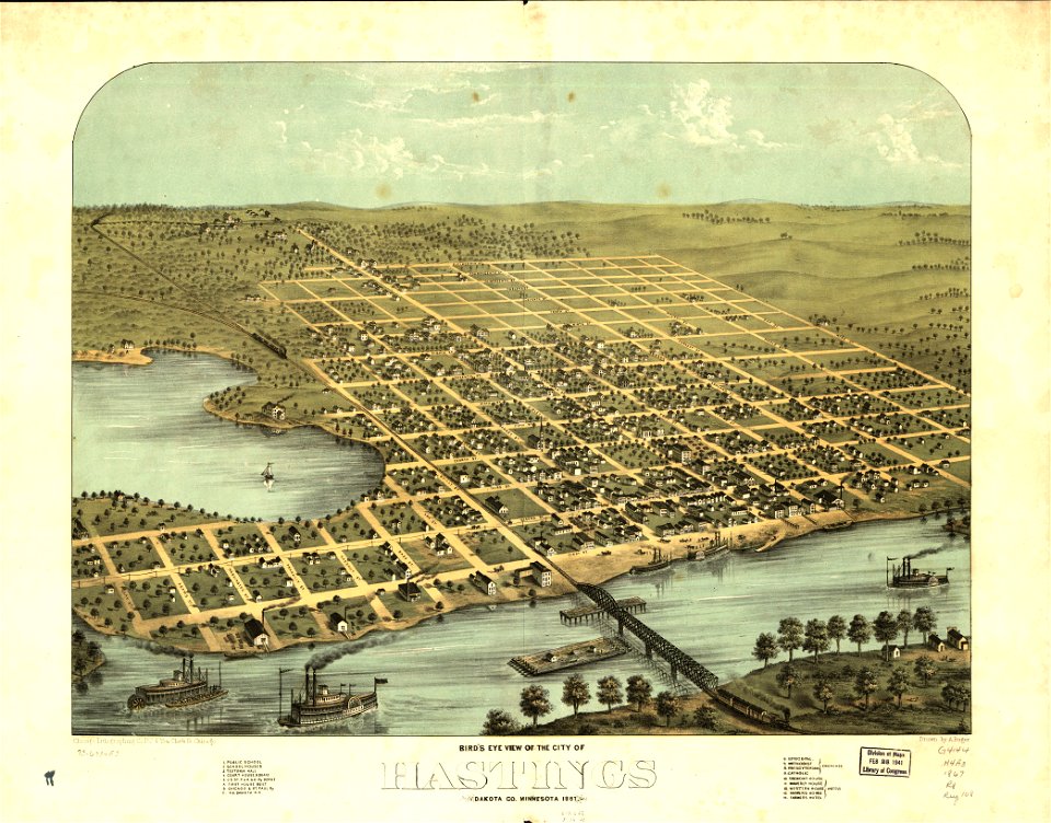
old maps of minnesota
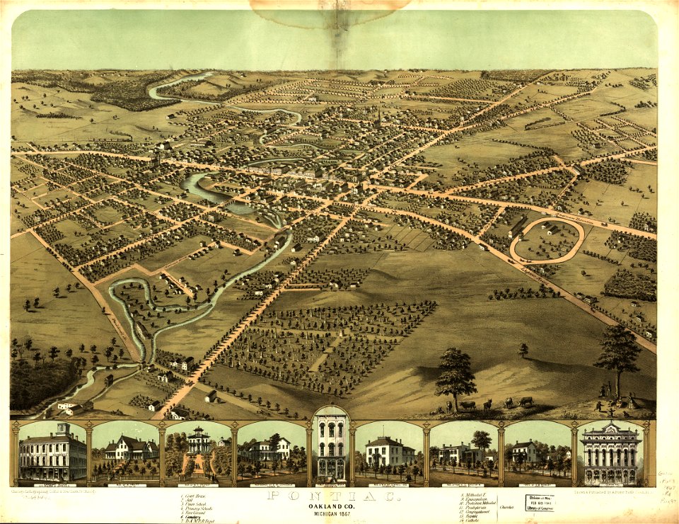
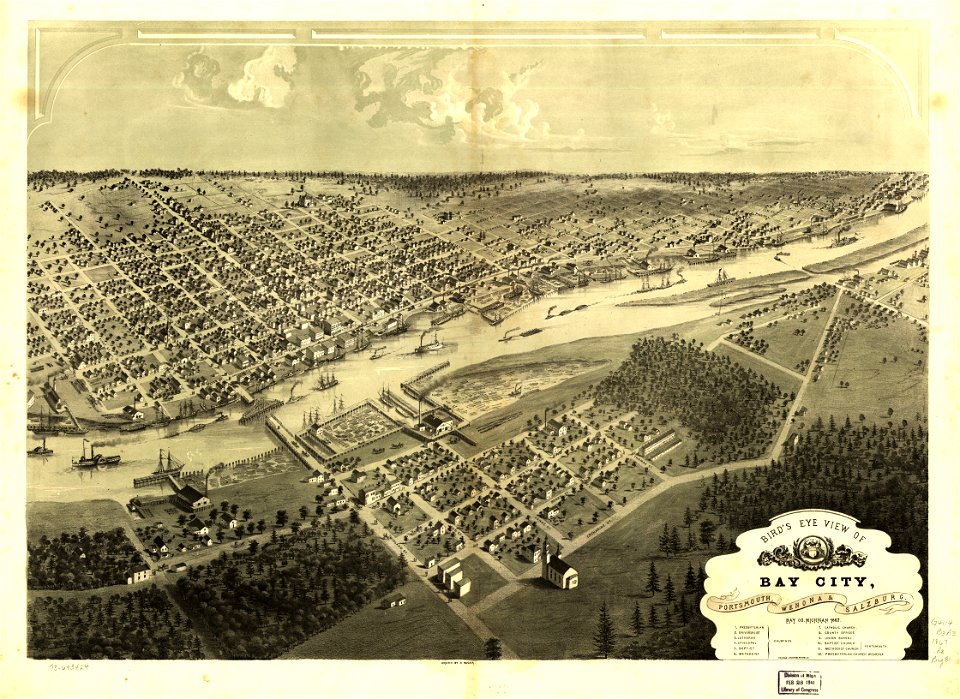
old maps of michigan
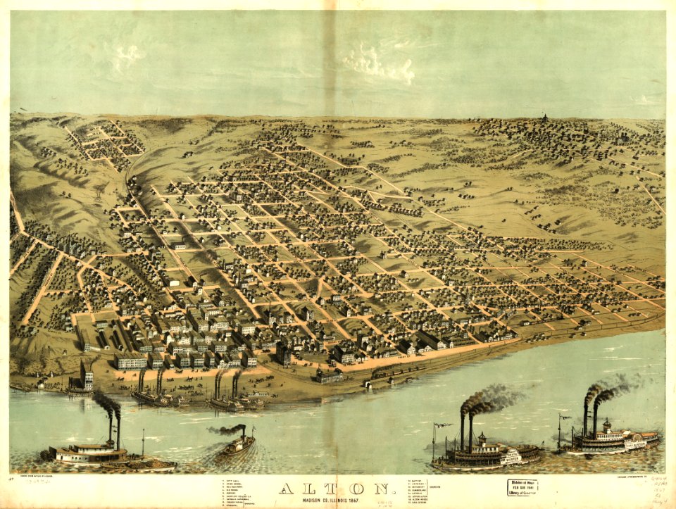
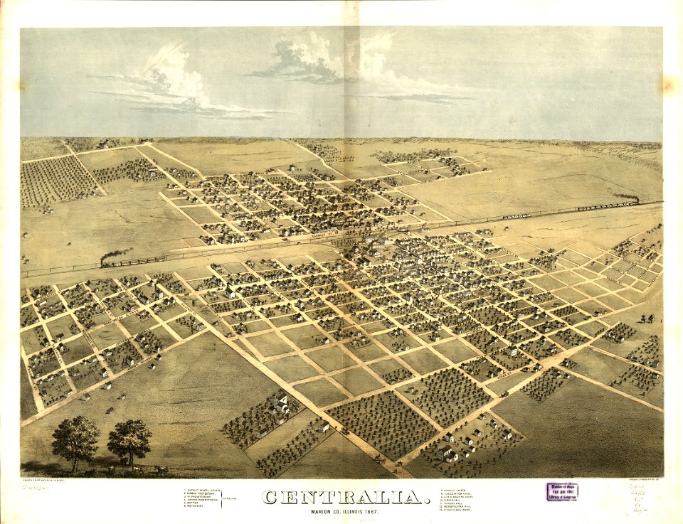
old maps of illinois
gemeente atlas van nederland - south holland
1860s maps of south holland
19th-century portrait paintings in the musée national du château de versailles
jean-adolphe beaucé
maps from the earth and its inhabitants, vol. vi
maps indicating exploration
self-published work
pages with maps
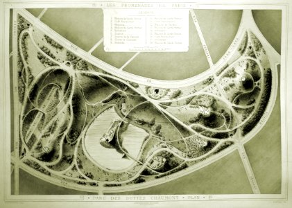
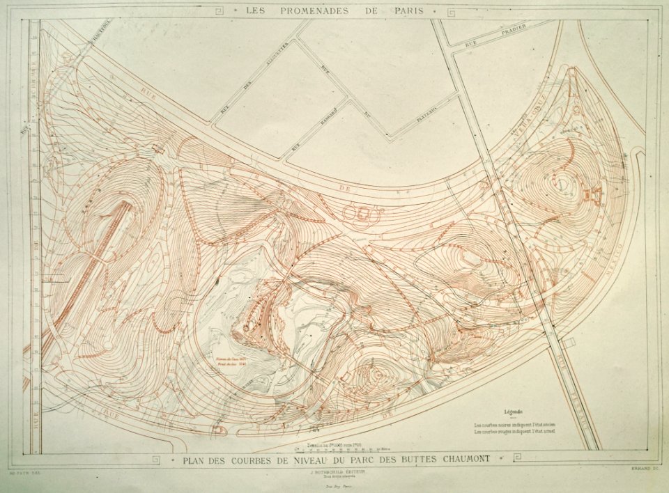
parc des buttes chaumont
maps of buttes chaumont
maps of buttes chaumont
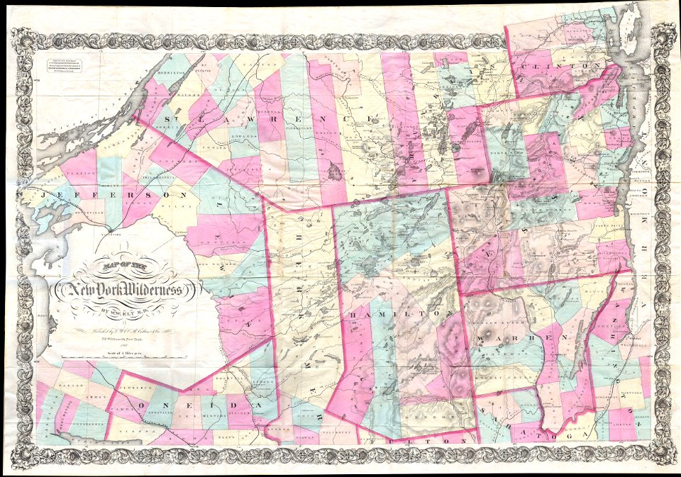
1867 maps
maps by joseph hutchins colton
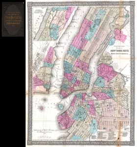
1867 maps of new york (state)
maps in the library of congress
1867 maps
maps in the library of congress
1867 maps
maps in the library of congress
1867 maps
maps in the library of congress
1867 maps
maps in the library of congress
1867 maps
maps in the library of congress
1867 maps
maps in the library of congress
1867 maps
maps in the library of congress
1867 maps
maps in the library of congress
1867 maps
maps in the library of congress
1867 maps
new york city
1867 maps
maps in the library of congress
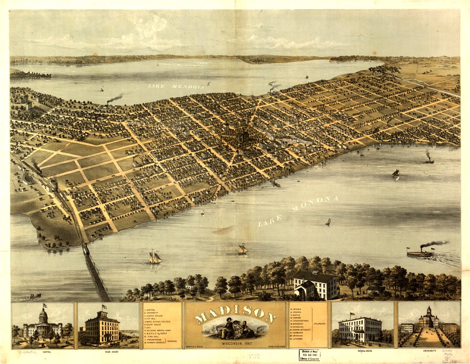
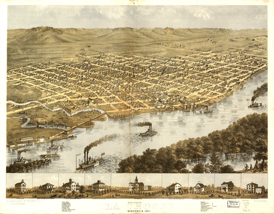
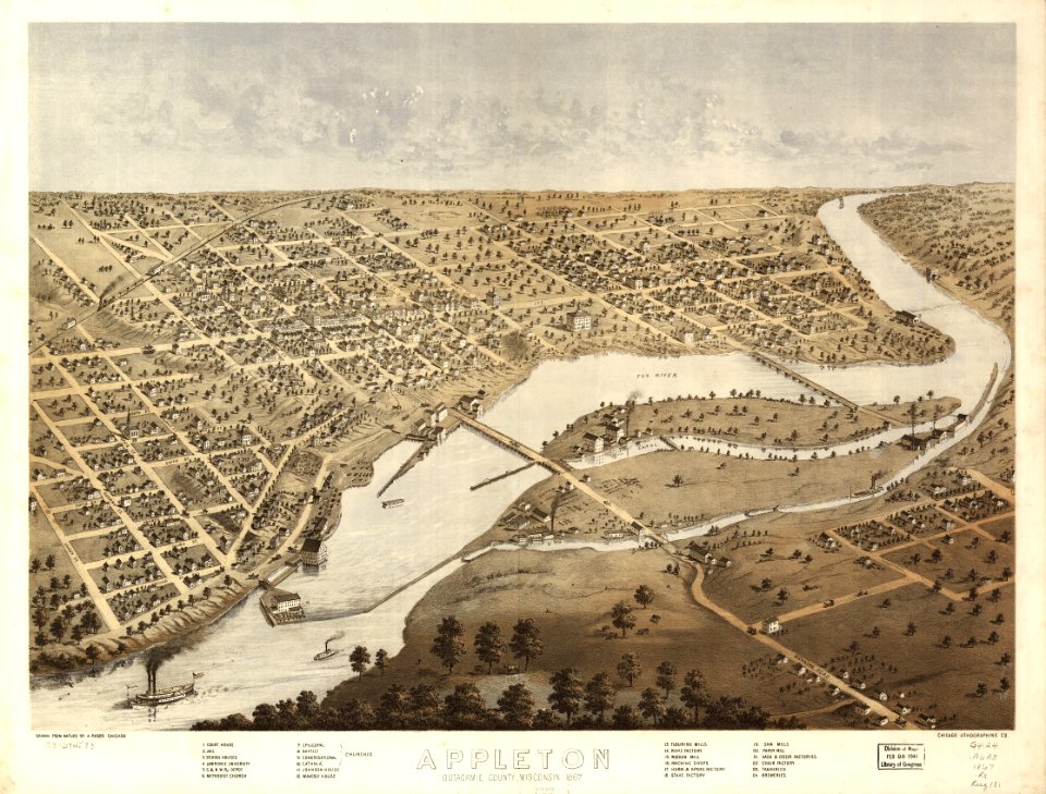
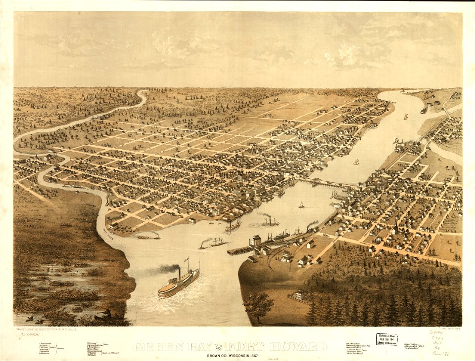
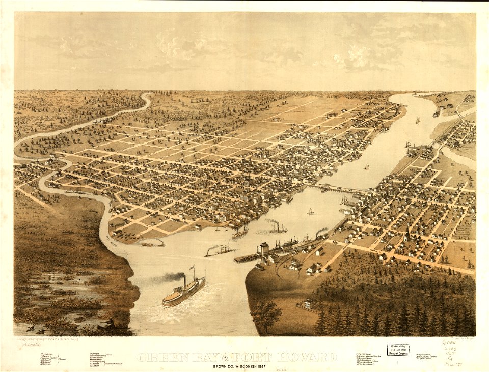
wisconsin
maps in the library of congress
1867 maps
maps in the library of congress
1867 maps
maps in the library of congress
1867 maps
maps in the library of congress
1867 maps
maps in the library of congress
1867 maps
maps in the library of congress
1867 maps
maps in the library of congress
1867 maps
maps in the library of congress
1867 maps
maps in the library of congress
1867 maps
maps in the library of congress
1867 maps
maps in the library of congress
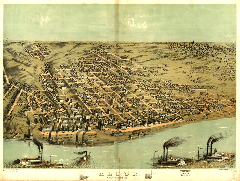
illinois
maps in the library of congress
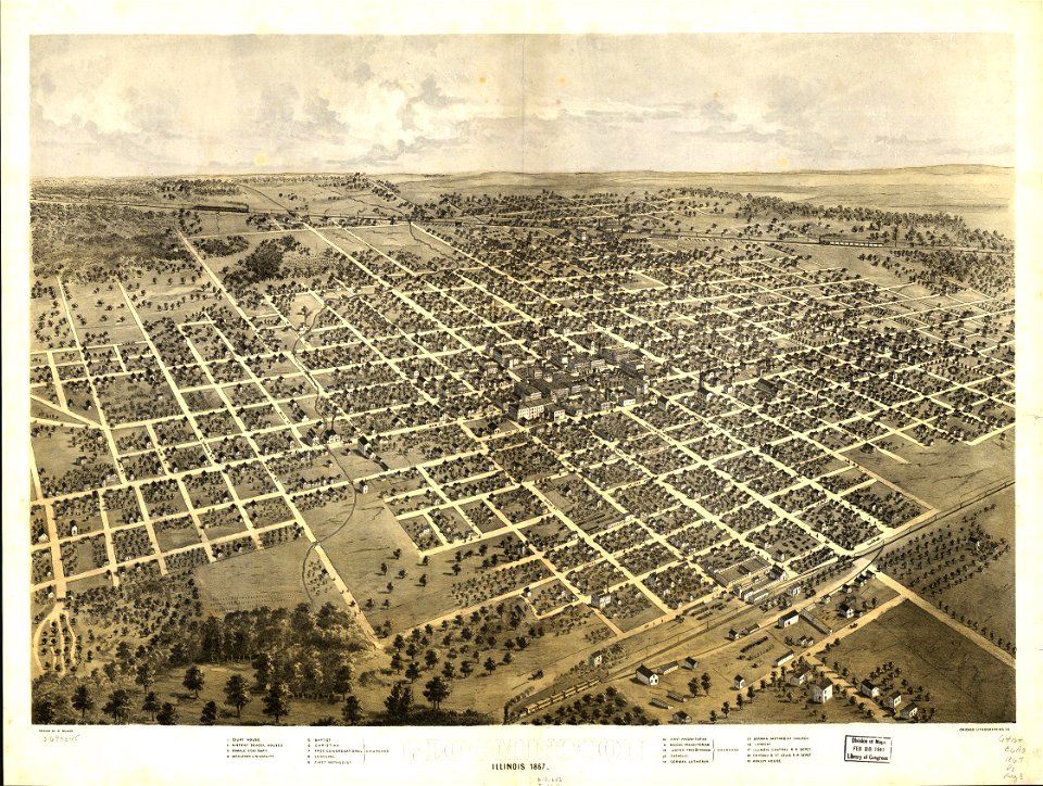
illinois
maps in the library of congress
1867 maps
maps in the library of congress
1867 maps
maps in the library of congress
1867 maps
maps in the library of congress
1867 maps
maps in the library of congress
1867 maps
maps in the library of congress
1867 maps
maps in the library of congress
1867 maps
maps in the library of congress
1867 maps
maps in the library of congress
1867 maps
maps in the library of congress
1867 maps
wisconsin
watertown
maps in the library of congress
1867 maps
maps in the library of congress
1867 maps
maps in the library of congress
1867 maps
maps in the library of congress
1867 maps
maps in the library of congress
1867 maps
maps in the library of congress
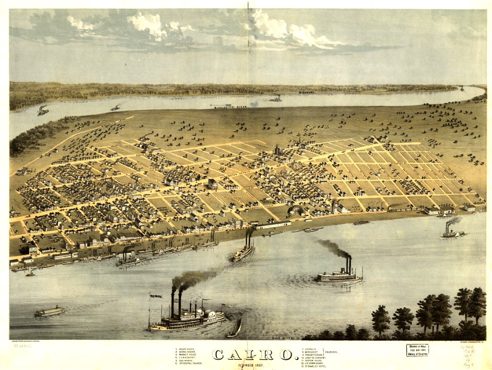
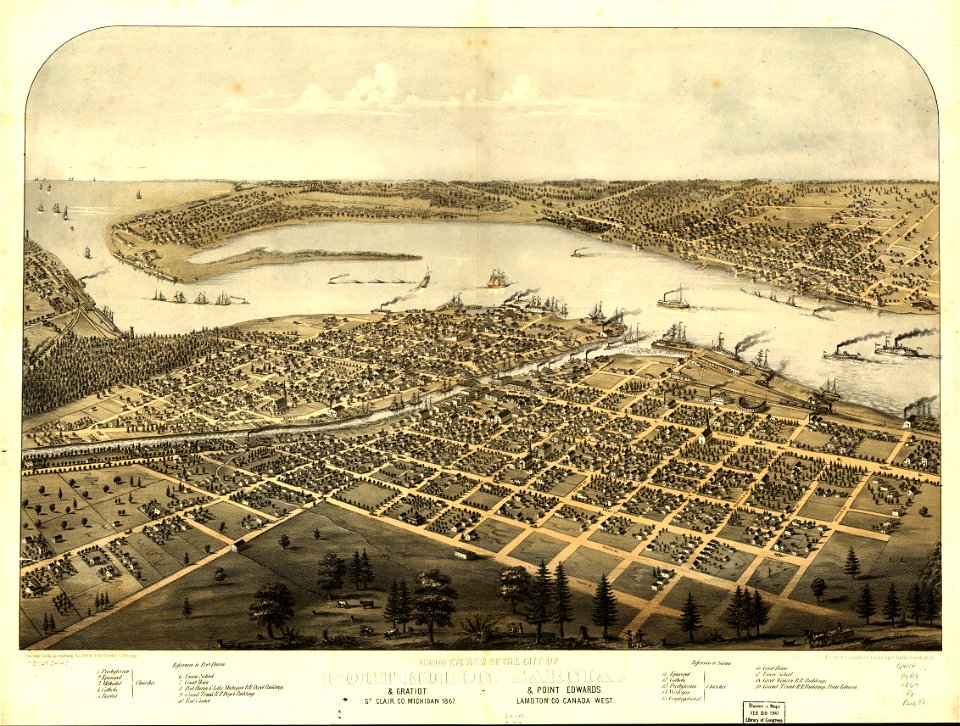
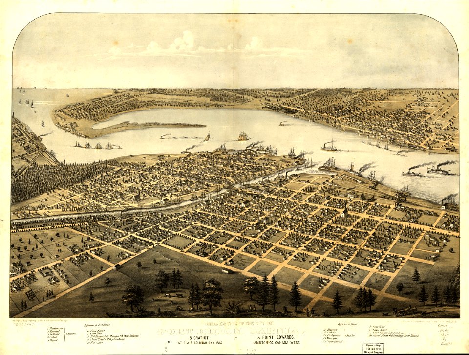
cairo
maps in the library of congress
cairo
maps in the library of congress
1867 maps
maps in the library of congress
1867 maps
maps in the library of congress
1867 maps
maps in the library of congress
1867 maps
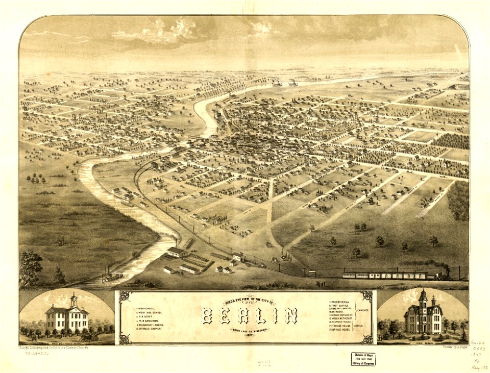
wisconsin
berlin
old maps of livorno
maps in the library of congress
1867 maps
maps in the library of congress
1867 maps
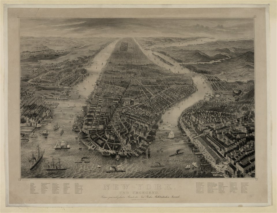
bird's eye view maps of new york city
1867 in new york city
1867 engravings
new york city
self-published work
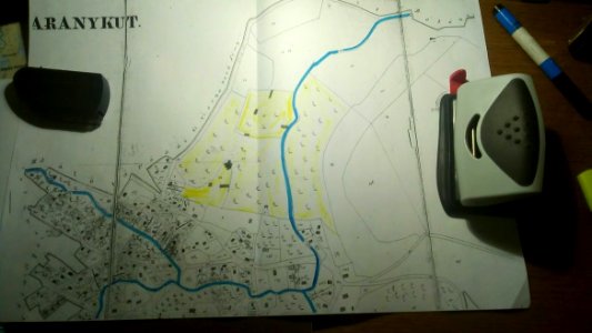
aruncuta, cluj
bird's eye view maps of new york city
1867 maps of new york (state)
1867 engravings
new york city
smoking men in art
maps in art
self-published work
sidewalk
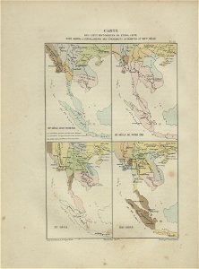
maps of indochina
francis garnier
maps with cartouches
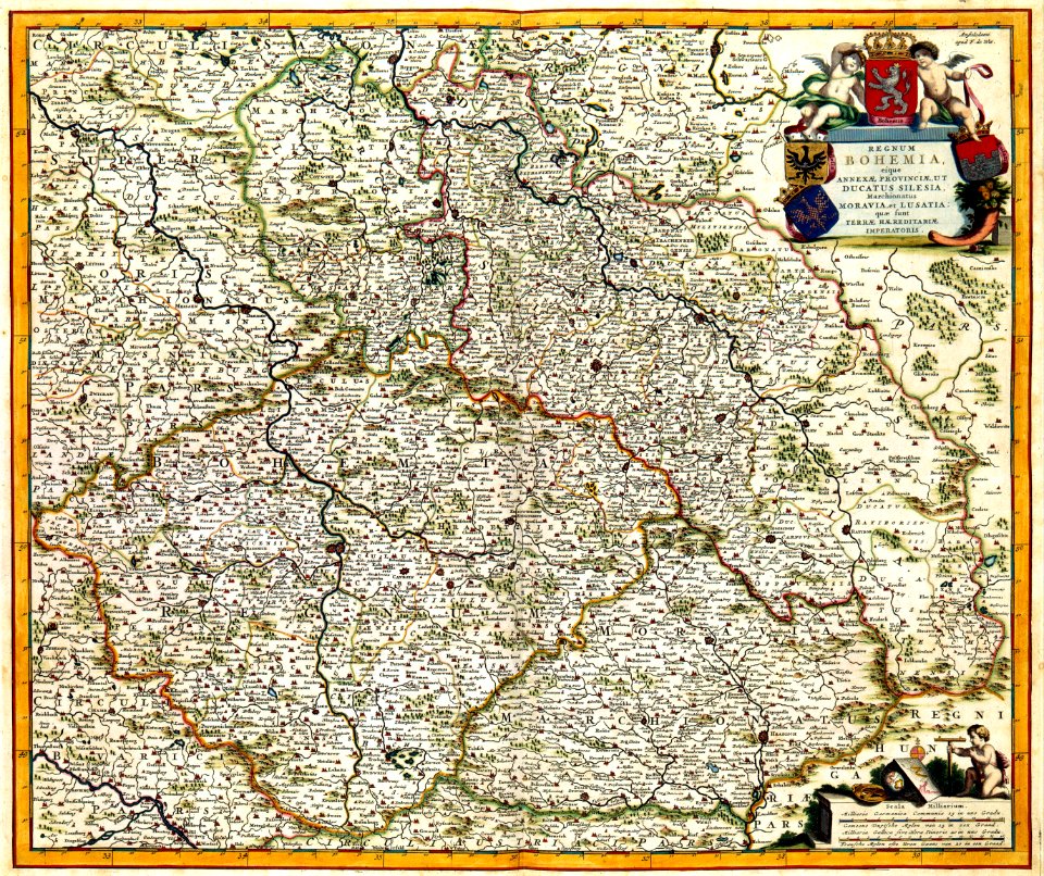
old maps of bohemia
old maps of cambodia
francis garnier
self-published work
pages with maps
vehicle
car
self-published work
pages with maps
self-published work
sidewalk
self-published work
pages with maps
self-published work
pages with maps
self-published work
garden
artworks without wikidata item
arnaud de vresse
self-published work
architecture
architecture
village
self-published work
town
grass
roof
architecture
village
architecture
city
self-published work
architecture
self-published work
lawn
roof
lawn
cornell's primary geography (1860)
1867 maps of canada
gemeente atlas van nederland - south holland
maps of zoeterwoude
19th-century maps of south holland
maps of veur
gemeente atlas van nederland - gelderland
netherlands in the 1860s
gemeente atlas van nederland - south holland
maps of noordeloos
gemeente atlas van nederland - limburg
old maps of venlo
gemeente atlas van nederland - south holland
1860s maps of south holland
gemeente atlas van nederland - south holland
maps of spijkenisse
dripps maps of manhattan published in 1867
neoclassicism
cornell's primary geography (1860)
1867 maps of africa
cornell's primary geography (1860)
1867 maps of asia
gemeente atlas van nederland - south holland
1860s maps of south holland
gemeente atlas van nederland - south holland
1860s maps of south holland
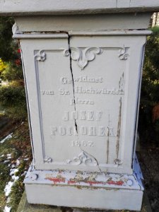
jaroslav zdeněk
josef farský
gemeente atlas van nederland - overijssel
netherlands in the 1860s
gemeente atlas van nederland - south holland
maps of abbenbroek
gemeente atlas van nederland - south holland
maps of heenvliet
1 - 100 of 310
Next page
/ 4